Projects
This project is the focus of PhD candidate Jasmine Hansen's research, funded through a Future Investigators in NASA Earth and Space Science and Technology (FINESST) fellowship.
Read More
Read More
Changes in sea level already impact coastal communities through erosion, storm surge, saltwater intrusion, and other effects.
Read More
We assess the interactions between mass movements, extreme precipitation, wildfire damage, and earthquakes and the potential for some sequence of these natural hazards to cascade into large-scale disasters.
Read More
The largest source of eustatic sea level rise during the past century is mass loss from land ice (ice sheets and glaciers) through meltwater runoff and solid ice discharge to the oceans.
Read More
Landscapes evolve extremely rapidly during and immediately after a natural disaster.
Read More
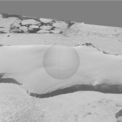
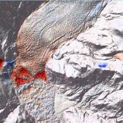
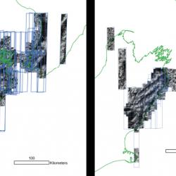
We are extracting three-dimensional topography from old air photos of Antarctica collected by Navy expeditions. We are automating the process as much as possible using python scripting.
Read More
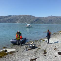
Glacial Isostatic Adjustment measurements from the polar regions are sparse. These observations are a critical correction for satellite missions that are measuring the changing mass of the ice sheets.
Read More