Michael Willis
- Cooperative Institute for Research on Environmental Sciences (CIRES)
- Department of Geological Sciences
- 2008 PhD. Ohio State University, Ohio
- 2000 MSc. Ohio State University, Ohio
- 1997 BSc (hons) Glasgow University, Scotland.
I run the 4-D topography lab in Boulder. I'm a fellow of the Cooperative Institute for Research in Environmental Sciences (CIRES) and am rostered in Geological Sciences.
Research Interests
My main research interests are in Glaciology, Crustal Deformation and High Resolution Topography. I am particulaly interested in linkages between the solid earth and the cryopshere. I employ drones, remote sensing and geodetic tools to tackle three main questions:
1) What is the contribution of land based ice to sea level change?
2) How are megacities going to cope with increasing sea level?
3) Where is the surface of the Earth and how does it change through time?
I spent much of my doctoral work traipzing around the Transantarctic mountains, participating in and organizing the logistics for 12 expeditions to the highest, driest, coldest and windiest of continents. I've also spent a couple of field seasons in the Arctic, in Svlabard and in Greenland. I enjoy pushing technology and seeing how computer vision algorithms can be used to both help analyze changing landscapes and present scientific information clearly and vibrantly to the public.
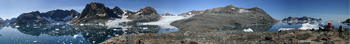
Pilgapik Island, East Greenland, 2007.