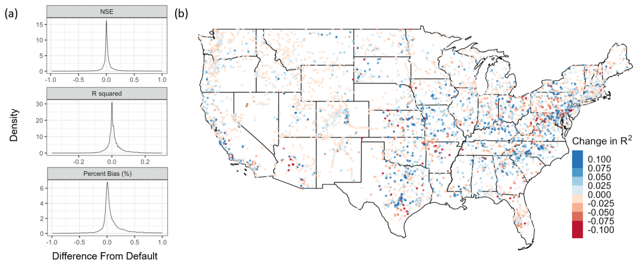
Regional- and continental-scale models predicting variations in the magnitude and timing of streamflow are important tools for forecasting water availability as well as flood inundation extent and associated damages. Such models must define the geometry of stream channels through which flow is routed. These channel parameters, such as width, depth, and hydraulic resistance, exhibit substantial variability in natural systems. While hydraulic geometry relationships have been extensively studied in the United States, they remain unquantified for thousands of stream reaches across the country. Consequently, large-scale hydraulic models frequently take simplistic approaches to channel geometry parameterization. Over-simplification of channel geometries directly impacts the accuracy of streamflow estimates, with knock-on effects for water resource and hazard prediction.
Here, we present a hydraulic geometry dataset derived from long-term measurements at U.S. Geological Survey (USGS) stream gages across the conterminous United States (CONUS). This dataset includes (a) at-a-station hydraulic geometry parameters following the methods of Leopold and Maddock (1953), (b) at-a-station Manning's n calculated from the Manning equation, (c) daily discharge percentiles, and (d) downstream hydraulic geometry regionalization parameters based on HUC4 (Hydrologic Unit Code 4). This dataset is referenced in Heldmyer et al. (2022); further details and implications for CONUS-scale hydrologic modeling are available in that article (https://doi.org/10.5194/hess-26-6121-2022).
If you use these data, please cite:
Enzminger, T. L., Minear, J. T., & Livneh, B. (2023). HyG: A hydraulic geometry dataset derived from historical stream gage measurements across the conterminous United States [Data set]. Zenodo. https://doi.org/10.5281/zenodo.7868764