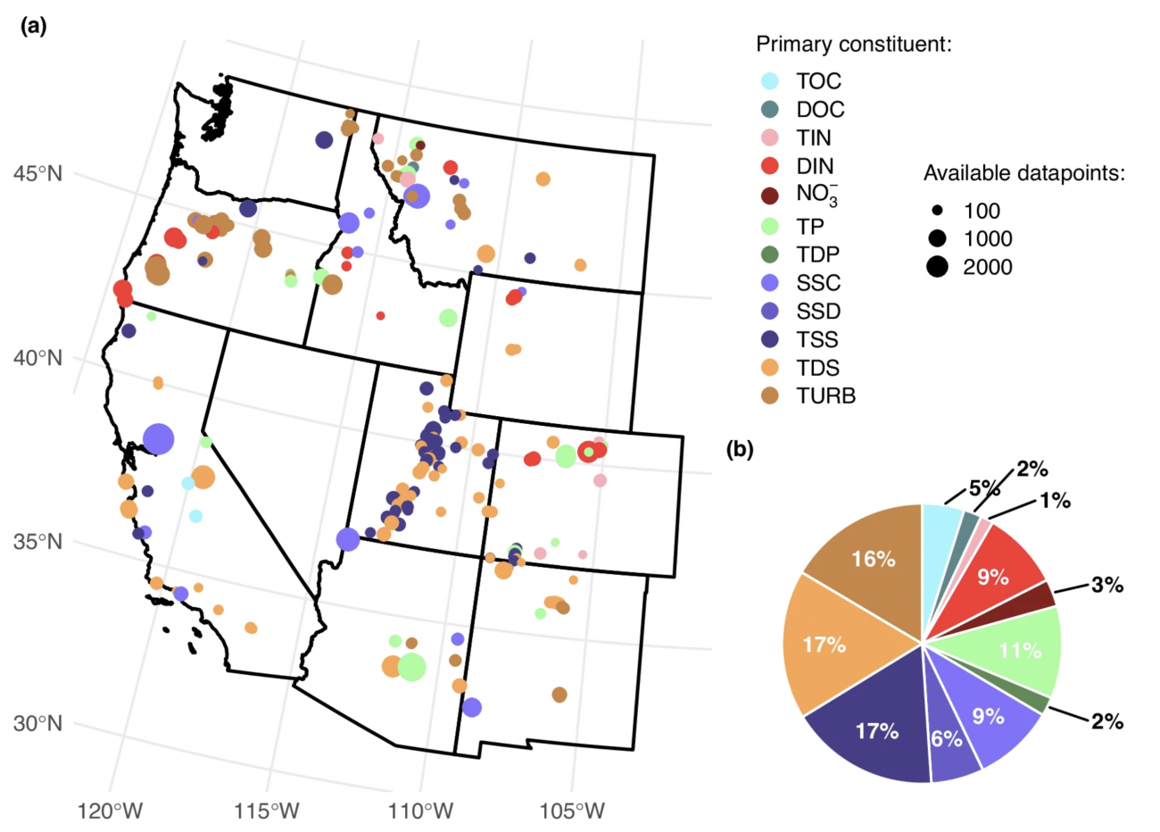
Information on the 245 burned basins, 293 unburned basins, and 356 associated fires from across the U.S. West which were used in statistical analyses of post-wildfire water quality response. Included are physiographic characteristics, as well as ESRI Shapefile polygons representing delineations for each basin and fire. Additionally, daily carbon, nitrogen, phosphorus, sediment, and turbidity data sampled from the basins' outlets are provided from 1974-2022. R programming scripts used in data processing and modeling also included.
Water quality data used to create this dataset are from the Water Quality Portal.
If you use these data, please cite:
Brucker, C., Livneh, B., Rosario-Ortiz, F., Yao, F., Williams, P., Becker, W., Kampf, S., & Balaji, R. (2024). Wildfires drive multi-year water quality degradation over the western U.S. (2.0.0) [Data set]. Zenodo. https://doi.org/10.5281/zenodo.11183128