
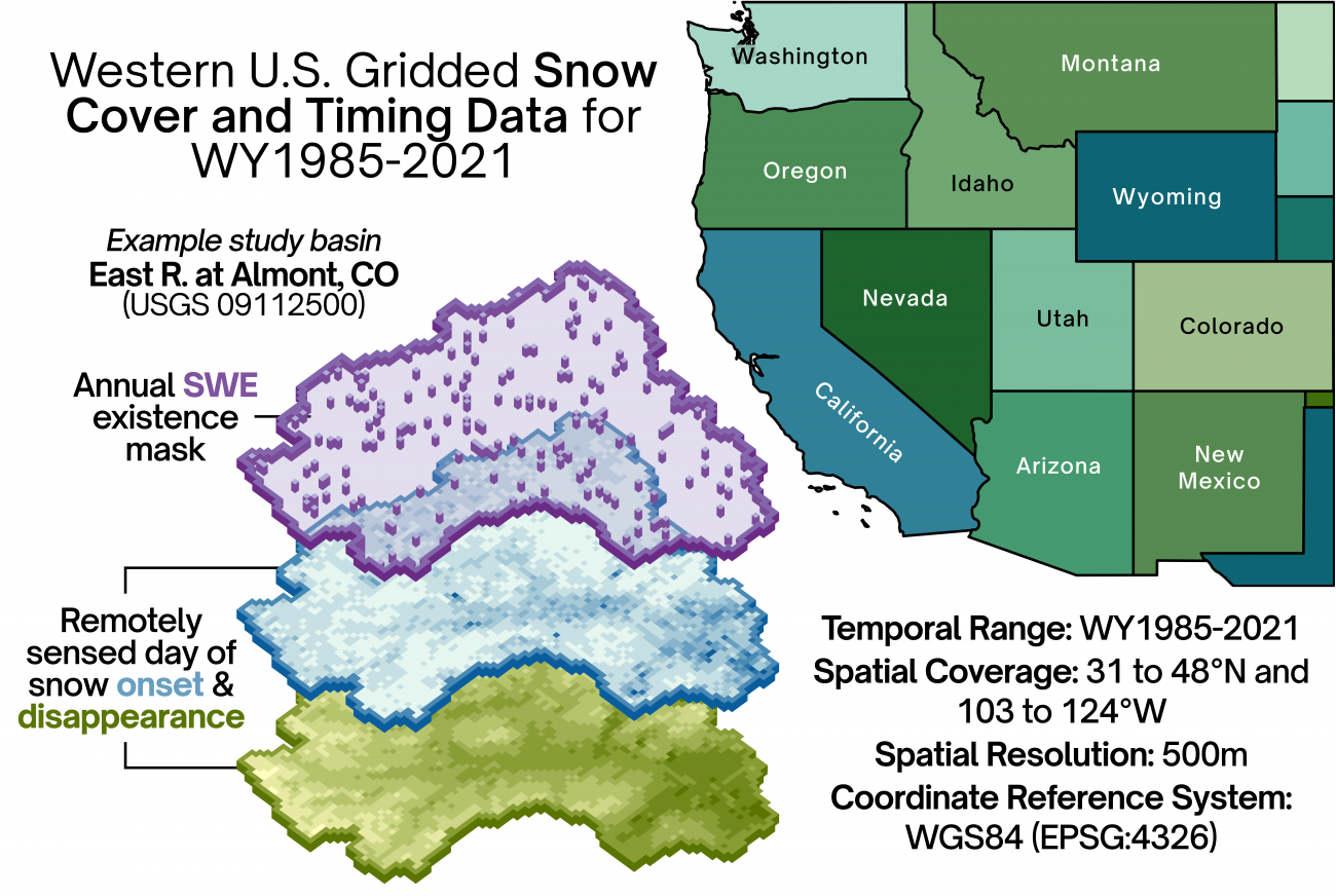
Gridded data is calculated from the UCLA Western U.S. Snow Reanalysis (WUS-SR), which is available at a 16 arc-second (500m) resolution for WY1985-2021 (Fang et al., 2022). Here, we utilize their daily median estimates of posterior snow water equivalent (SWE) and fractional snow-covered area (fSCA) to identify dates of snow onset (DSO) and disappearance (DSD) for each grid cell and water year. Processed snow timing files are available on the same 1° by 1° grid as the reanalysis, for 31°-48°N and 103°-124°W, and are georeferenced to the World Geodetic System 1984 spatial grid (EPSG:4326). These files follow the naming convention "ST_N<latitude>_0W<longitude>.nc", where each file includes snow timing data for all water years at that location. Data processing follows a similar rationale to that of Heldmyer and Livneh (2021) with modifications (as needed) due to differences between utilized fSCA products, a longer period of record, etc.
We calculate snow cover timing indices for each file in the WUS-SR as follows. First, we create daily binary snow cover maps which identify snow existence based on a 10% fSCA threshold (i.e., if a grid cell has a fSCA lower than this threshold, it is considered 'snow-free'). This is a departure from the methods described by Heldymer and Livneh (2021), where they apply a 25-day moving median window before classifying grid cells as snow-covered or snow-free. For a given water year, the DSO is calculated as the first day when a grid cell transitions from snow-free to snow-covered. Conversely, the DSD is calculated as the first day when a grid cell transitions from snow-covered to snow-free after the date of maximum SWE. This constraint aims to minimize the effect of small-scale deposition and melt events on the data. These snow timing dates are reported as day of water year (DOWY) values rather than day of calendar or Julian year. Additionally, the creators of the WUS-SR data state that their products are not intended to represent non-seasonal snowpack (e.g., grid cells which do not transition from snow-free to snow-covered, or vice versa). Here, we also provide a SWE 'existence' mask for each water year, where we identify grid cells that never experience snow accumulation—meaning their estimated SWE never exceeds zero meters—for any date of each water year.
If you use these data, please cite:
Bishay, K., & Livneh, B. (2025). Western U.S. Gridded Snow Cover and Timing Data for WY1985-2021 (Version 1) [Data set]. Zenodo. https://doi.org/10.5281/zenodo.15284150https://zenodo.org/records/15284150