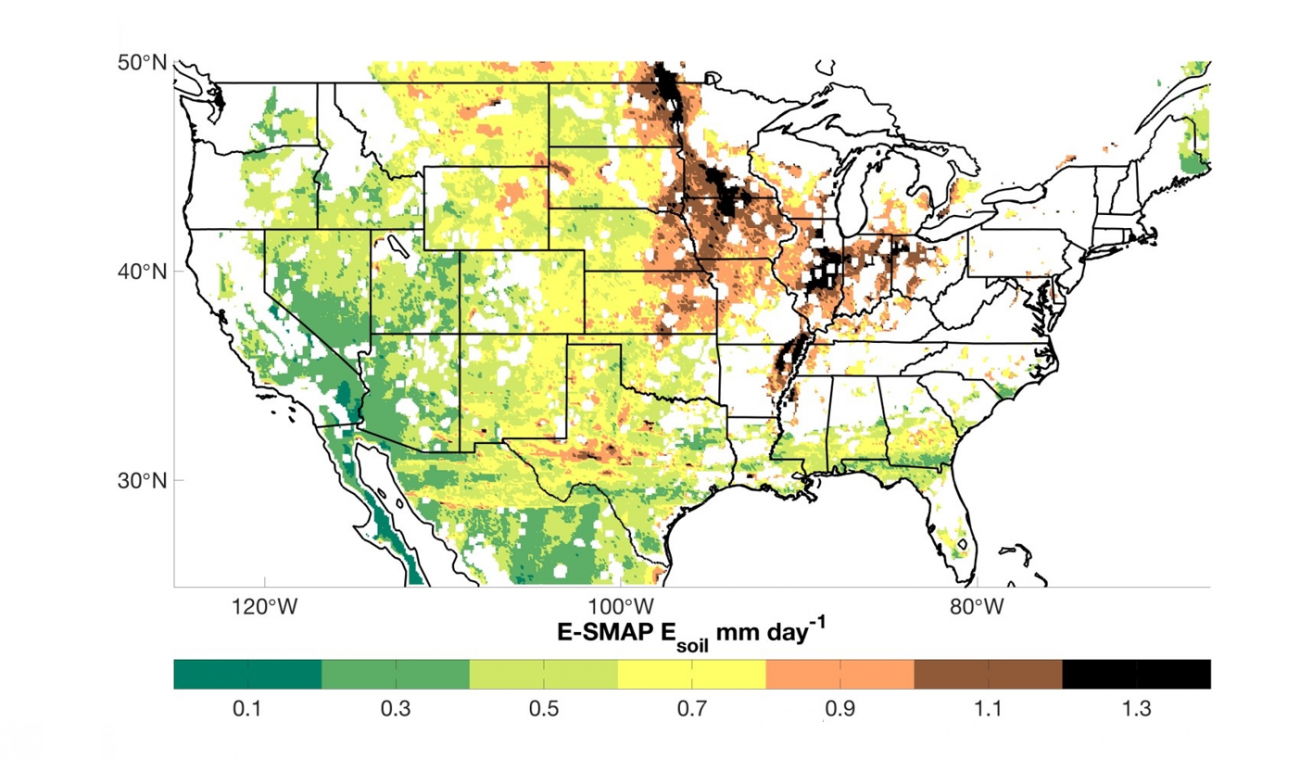
This is an observationally-based dataset of soil evaporation for the conterminous U.S. (CONUS), gridded to a 9 km resolution for the time-period of April 2015-March 2019. This product (Evaporation-Soil Moisture Active Passive; E-SMAP) represents soil evaporation from the surface layer, defined by the SMAP sensing depth of 50 mm, during SMAP overpass intervals that are screened using precipitation and SMAP quality control flags. Soil evaporation is calculated through an estimated water balance of the surface soil, which we show is largely dominated by SMAP-observed soil drying. E-SMAP soil evaporation is on average 0.72 mm day-1, which falls within the range of soil evaporation estimates (0.17-0.89 mm day-1) derived from operational land surface models and an alternative remote sensing product that are used for comparison (Abolafia-Rosenzweig et al., in review). E-SMAP is independent from existing soil evaporation estimates and therefore has the potential to improve understanding of evapotranspiration partitioning and model development. Moisture flux estimates in the E-SMAP dataset represent the average flux over the interval and are reported at the mid-date of respective intervals. The E-SMAP dataset may be used to estimate soil evaporation over a time period of months or years. However, soil evaporation estimates at individual time steps should be used with caution because unbiased uncertainty in observed drying rates from the SMAP satellite will introduce noise into shorter-interval estimates. All scripts used to create and assess this dataset are accessible here: https://github.com/ronzoni9675/ESMAP/.
If you use these data please cite:
Abolafia-Rosenzweig, Ronnie; Badger, Andrew; Small, Eric; Livneh, Ben (2020), “E-SMAP: Evaporation-Soil Moisture Active Passive”, Mendeley Data, V1, doi: 10.17632/ffw8zbdmpm.1
